|
617 NW 20th Avenue Gainesville, Florida 32609 Tel: 352.367.1700 |

|
|
|
Terrain Differences rfSoftware products currently use 3 different terrain databases: 30-second data from the FCC, 30-second data from the GLOBE (Global Land One-km Base Elevation) project and 3-second data from the USGS. Below is a sample of each from the Boston/Cape Cod area shown at 1:1,000,000 scale. In rfProfiler Light, you don't see the terrain in this form, but seeing it this way will give you a better sense of the differences.
| |||||
|
|
rfSoftware | About | Features | Screenshots | Pricing | Downloads rfDetective-FM | rfInvestigator-FM | rfProfiler Light Copyright © 2004, rfSoftware, Inc. |


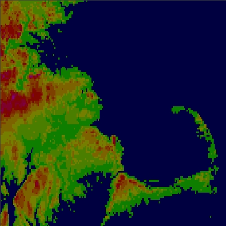 The primary limiting factor in this data is its 10-meter vertical resolution. Notice that
much of the low-lying terrain registers as 0 meters elevation.
The primary limiting factor in this data is its 10-meter vertical resolution. Notice that
much of the low-lying terrain registers as 0 meters elevation.
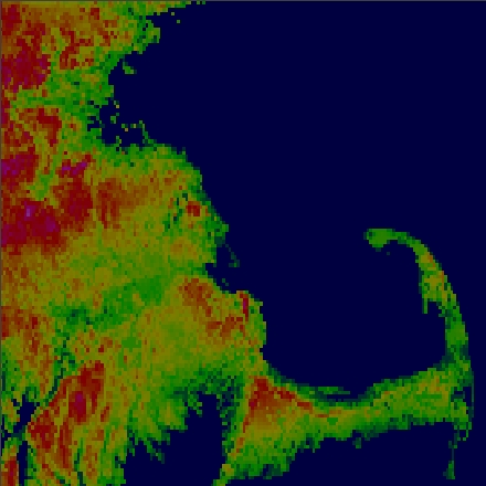 The GLOBE data has 1 meter vertical resolution. Notice the greater degree of variation
compared to the FCC data.
The GLOBE data has 1 meter vertical resolution. Notice the greater degree of variation
compared to the FCC data.
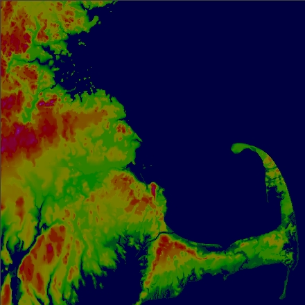 3-second terrain data is 100 times denser (10 times in each direction) than the
30-second data.
3-second terrain data is 100 times denser (10 times in each direction) than the
30-second data.